One example of the results of this collaboration within the GeoVT project is the formalization of courses on Geomorphological and Hydrological Hazards and Imagery, Remote Sensing and Geomatic Tools. With a lengthy and up to date presentation of advanced methods for mitigating and assessing geological risks and hazards, with emphasis on landslides, coastal dynamics (i.e., cliff retreats), climate change, sea-level rise, floods, and erosion.
The presentation of these methods is endowed by state-of-the-art terrestrial and airborne observational technologies (such as LIDAR and laser scanners) to accurately measure displacements on the face of the earth. Subsequently, it continues with multi-temporal and multi-source geological data analysis, by using specialized equipment tools (i.e., piezometers and inclinometers), and examining how the data from such recordings can be used for morphodynamic mapping of heterogeneities, kinematic patterns, and other factors of interest for geological hazards assessment.
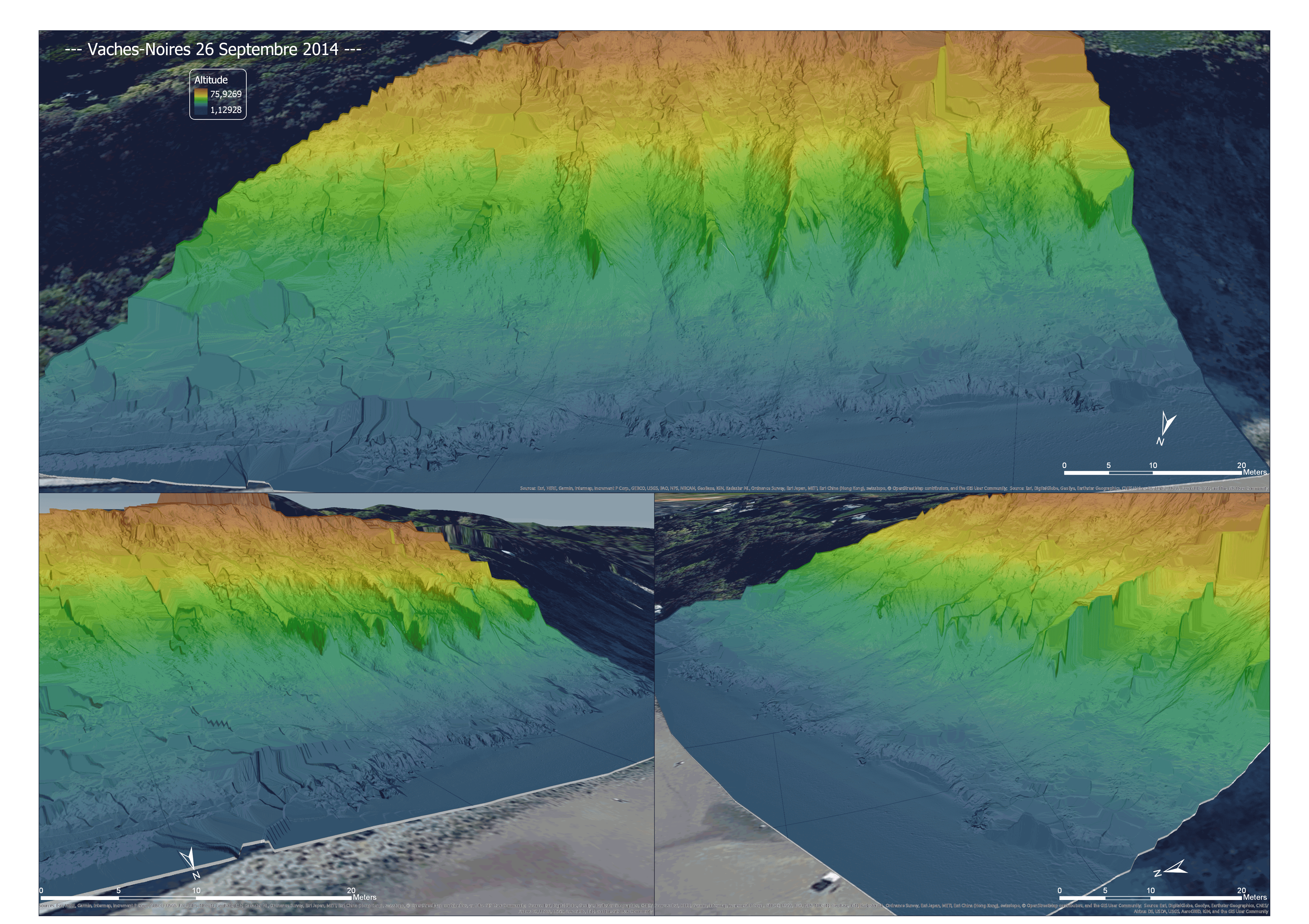
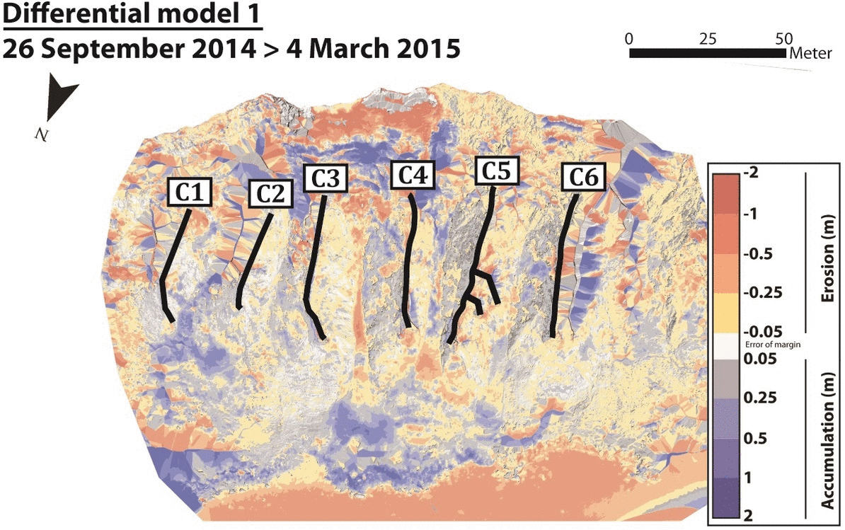
Thus, allowing fine diachronic monitoring of the areas studied (following figures: fig.1_ digital elevation model of the Vaches-Noires site, Normandy, France from 2014 to 2017; fig.2_ spatialisation of accumulation and erosion zones on the Vaches-Noires site, Normandy, France from 2014 to 2019).